Boston-area Wednesday night forecast: colder air follows wintry mix, with slippery travel risk into Thursday morning
What’s changing Wednesday night
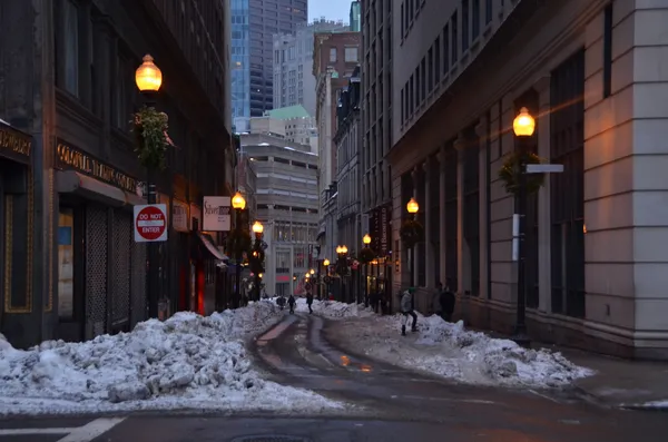
A transition to colder, drier air is expected across Greater Boston Wednesday night as a weak storm system exits New England and temperatures fall after sunset. The setup follows a familiar early-March pattern: marginal daytime temperatures allow precipitation to shift between rain and wintry types, while nighttime cooling increases the chance of refreezing on untreated surfaces.
In the city and along the immediate coastline, temperatures typically hover closer to freezing during late-night hours when winds turn more northerly, limiting how quickly roads can dry. Farther inland—especially in higher elevations and communities away from the ocean’s moderating influence—temperatures are more likely to dip below freezing, a key threshold for black ice.
Precipitation and road conditions
By Wednesday evening, any lingering light precipitation is expected to taper, but the main concern shifts from falling precipitation to residual moisture. Where earlier rain or mixed precipitation has occurred, the risk is that wet pavement, sidewalks, and parking lots may glaze over as temperatures drop into the 20s and lower 30s.
Highest risk areas: inland suburbs, shaded roadways, bridges and overpasses, and spots that received a period of sleet or freezing rain earlier in the day.
Lower risk areas: immediate coastal locations where temperatures can remain nearer to freezing and roads are more likely to stay wet rather than icy.
How this fits into the late-week outlook
Wednesday night’s cooling comes as forecasters track another round of unsettled weather later in the week. A separate system is expected to approach Thursday into early Friday with the potential for additional mixed precipitation, including snow, sleet, and pockets of freezing rain before precipitation changes type. While this next event is not expected to be defined by extreme snowfall rates, early indications suggest it could again create localized travel problems—especially during evening and morning commute windows.
For drivers, the most important variable Wednesday night is not how much precipitation falls, but how quickly temperatures drop after roads become wet.
What to watch through Thursday morning
Key indicators for deteriorating conditions include rapid temperature drops after 9 p.m., clearing skies that promote faster radiational cooling, and a shift to a light breeze that can dry some surfaces while leaving others prone to refreeze. Travelers should be prepared for spotty slick conditions rather than uniform icing, a scenario that can make hazards harder to detect.
With another mixed-precipitation system possible late Thursday, Wednesday night serves as a short, colder interlude—one that may still carry outsized impacts if refreezing develops in areas that remain damp.