Frostbite Alert: Arctic Chill Grips Boston Ahead of Incoming Weekend Blizzard
Frostbite Friday’s Frigid Hangover: Arctic Blast Grips Boston
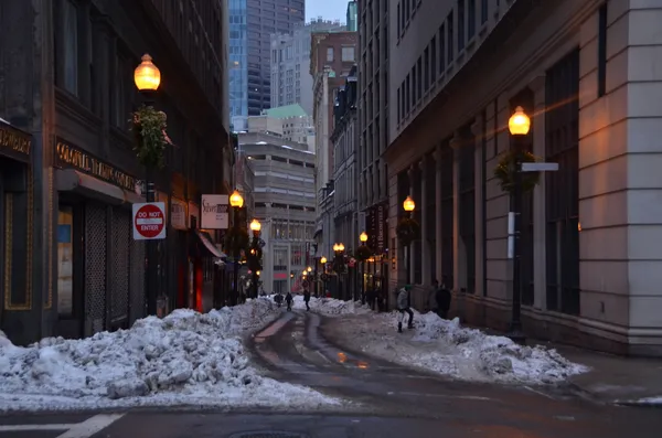
Boston residents are waking up to a bone-chilling reality this Saturday, January 24, 2026, as an Arctic air mass settles firmly over the region. While the sun may be shining, the primary story today is the extreme cold, with Mayor Michelle Wu’s previously declared cold emergency remaining in full effect. This deep freeze serves as a frigid prelude to a major winter storm expected to bury the city starting tomorrow.
Morning: Dangerous Wind Chills and Cold Advisories
The early hours are the most hazardous. A Cold Weather Advisory is currently in effect through 10:00 AM. Temperatures at sunrise hovered between 1°F and 4°F, but the real danger lies in the wind chill. According to the National Weather Service and local meteorologists, wind chill values in the morning are reaching as low as -10°F to -30°F. Health officials warn that frostbite can occur on exposed skin in less than 30 minutes under these conditions.
- Conditions: Sunny but dangerously cold.
- Safety Notice: Boston Centers for Youth & Families (BCYF) have been activated as warming centers for those in need. Residents are encouraged to check on elderly neighbors and those experiencing homelessness.
Afternoon: Deceptive Sunshine and Arctic Air
As the day progresses, the sun will remain a constant fixture in the sky, though it will provide little warmth. The high temperature for the afternoon is expected to reach only 14°F. Northwest winds of 8 to 10 mph will persist, with occasional gusts reaching up to 23 mph. Even at the peak of the day, wind chill values will likely remain well below zero, making outdoor activities risky without significant thermal protection.
Evening: The Calm Before the Storm
Clouds will begin to increase Saturday evening as the atmosphere shifts in preparation for a potentially historic winter storm. Temperatures will drop back down to a low of approximately 6°F overnight. While the winds may relax slightly to 3-6 mph, the focus for the evening will turn toward final storm preparations. A Winter Storm Warning has already been issued for Sunday morning, with meteorologists predicting 15 to 22 inches of snow beginning midday tomorrow.
Today’s Summary at a Glance
- Temperature Range: Daytime high of 14°F / Nighttime low of 6°F.
- Wind Chill: Reaching as low as -30°F in the early morning hours.
- Wind: Northwest at 8-10 mph with gusts up to 23 mph.
- Warnings: Cold Weather Advisory (active until 10 AM) and a city-wide Cold Emergency declaration.