Slippery Commute Ahead: Wintry Mix to Blanket Boston This Evening
A Frigid Morning Start
Bostonians should keep their ice scrapers within reach as a new weather system moves into the region this Tuesday, March 3, 2026. Following the wake of recent winter activity, the city is preparing for a transition from a frigid, clear morning to a messy, slushy evening. The day began with a sharp bite in the air, as temperatures plummeted to a low of 15°F during the early hours. Early risers likely noticed clear skies and high humidity around 77%, creating a frost-covered landscape across the Greater Boston area. While the morning commute should remain dry, residents will see clouds thickening quickly by mid-morning as a wintry system tracks northward from the Mid-Atlantic states.
Afternoon and Evening Forecast
As we move into the afternoon, temperatures are expected to climb toward a daytime high of 36°F to 38°F. This slight rise above the freezing mark is critical; it suggests that initial precipitation, arriving between 2:00 PM and 4:00 PM, will likely manifest as a wintry mix of rain, sleet, and wet snow. However, as the sun sets around 5:36 PM, the mix will transition toward more consistent light snow. Meteorologists predict a 65% chance of precipitation throughout the late afternoon and evening hours. Winds today will be relatively manageable, primarily coming from the south at approximately 12 mph.
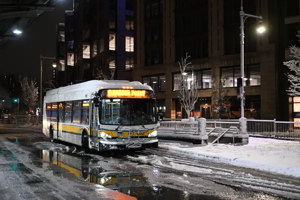
Travel Alerts and Accumulations
The primary concern for today is the evening rush hour. While the inner city may see mostly slush, the northern and western suburbs are under a close watch for the following conditions:
- Accumulations of 1 to 3 inches of snow through Tuesday night.
- A 'crusty layer of ice' potentially forming on top of the snow as temperatures fluctuate.
- Treacherous travel conditions on elevated surfaces, bridges, and overpasses.
- Potential for school delays or early dismissals in districts north and west of the city.
Overnight Outlook
Overnight, the mercury will drop back down toward a low of 25°F as the system begins to pull away. While today presents a wintry challenge, relief is on the horizon. A significant warmup is forecasted to begin tomorrow, with temperatures potentially reaching the 50s by the end of the week. For tonight, however, the focus remains on navigating the slick streets and staying safe on the roads. Drivers are encouraged to allow extra time for their travels and to ensure their vehicles are fully cleared of any ice or snow accumulation before heading out.