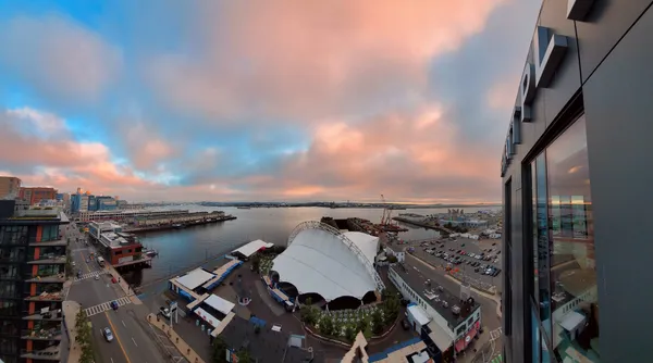
Sun Peaks Through as Boston Battles Lingering Wind Chills and Coastal Flood Alerts

A Cold but Bright Transition
Bostonians waking up this Monday morning, February 2, 2026, will find themselves at a weather crossroads. After enduring the coldest air of the season over the weekend, the city is beginning a slow recovery. While the morning remains bitterly cold, with actual temperatures near 13°F and wind chills making it feel like 0°F, a shift is on the horizon. Clouds are expected to break by midday, giving way to a sunny afternoon that will see the mercury climb toward a high of 30°F.
Coastal and Safety Warnings
Despite the promise of afternoon sunshine, the day is not without its hazards. An offshore ocean storm continues to influence local conditions, prompting active alerts from the National Weather Service. Residents and commuters should take note of the following conditions:
- Coastal Flood Advisory: A formal advisory remains in effect for Suffolk County and the Boston harbor area until 2:00 PM today. Minor tidal flooding is expected during the morning high-tide cycle, which may lead to shallow flooding on shore roads and in low-lying coastal districts.
- Wind Impacts: Strong winds associated with the offshore system are beginning to diminish, but gusts up to 45 MPH were recorded earlier this morning. Isolated pockets of tree or wire damage remain possible through the first half of the day.
- Persistent Cold: With temperatures struggling to reach the freezing mark, the legacy of the weekend's arctic blast remains. Pedestrians should watch for "black ice" on sidewalks and secondary roads where previous snow or sea spray may have frozen solid.
Evening Outlook and the Week Ahead
As the sun sets at approximately 4:59 PM, the brief warming trend will stall. Clear skies overnight will allow for significant radiational cooling, with temperatures plunging back toward a low of 3°F. This deep freeze ensures that any moisture on the ground will remain frozen through the Tuesday morning commute.
Looking further into the week, meteorologists predict a continued but slow rise in temperatures. Tuesday is expected to reach 32°F, finally touching the freezing point and allowing for more substantial melting. However, the region remains in an active winter pattern; a "clipper" system is currently being tracked for Wednesday morning, which could bring a fresh coating of light snow to the area. For today, the best strategy for those in the city is to dress in heavy layers, remain mindful of the coastal tides, and enjoy the return of the sun after a brutal weekend stretch.